
BRUNTON MAP MULTI-TOOL CARD
Original price was: $13.11.$9.96Current price is: $9.96.
- Your happiness, our mission.
- Free Shipping, No Compromise on Quality
- Efficient and effective customer service, online.
- Safe Transactions, Always

An all-in-one tool that includes standard and metric rulers, Romer grids for common map scales, and a unique protractor for measuring and plotting angles
FEATURES
• Waterproof, durable, and lightweight cards can handle exposure to any type of weather.
• Card data:
– Inch/10ths and cm/mm rulers.
– Romer Scales for UTM grids at various map scales.
– Map rulers for various map scales.
– 360 degree protractor with unique open circle and strike & dip crosshairs.
• Useful for geologists and other field professionals.
SPECS
3 x 6 x 0.03” | 7.6 x 15.2 x 0.7cm
0.4oz | 11.3g
Be the first to review “BRUNTON MAP MULTI-TOOL CARD”
Related products

Alexapure
Camping & Hunting
Appliances


Camping & Hunting
2-Way & Emergency Radios
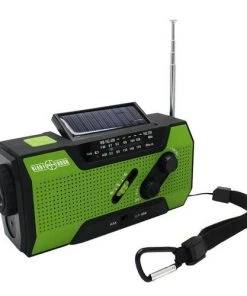
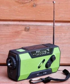
Ready Hour Hand-Crank AM/FM Emergency Radio & Solar Flashlight


Camping & Hunting
Backpacks & Bags
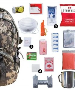
ReadyWise 64 Piece Survival Backpack- Camo Food & Food Storage
Reviews
There are no reviews yet.